| # | Documents | Filesize |
|---|
The Coral Triangle Day is celebrated across the region by different groups in many different ways. Click on the photos below to go to the Countries' The Coral Triangle Day Galleries and view some images and snippets that we have so far received of this year's celebrations.
- Type:
- Photos, Videos, and Maps
- Country:
- Indonesia |
- Philippines |
- Solomon Islands |
- Malaysia |
- Papua New Guinea |
- Timor-Leste
| # | Documents | Filesize |
|---|
Video presented at the first CTI High Level Financial Roundtable in Manila on May 3, 2012.The video was prepared by the ADB Knowledge Management for CTI Project.
To see the vide, follow this link
| # | Documents | Filesize |
|---|---|---|
| 1 | 583,764 KB |
- Subject:
- CTI-CFF Secretariat
- Type:
- Photos, Videos, and Maps
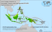
This map document displays the extended economic zones agreeable to the CT6 countries. For more information, see the regional map page on the CTI-CFF site.
| # | Documents | Filesize |
|---|
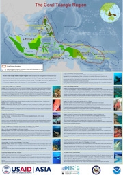
Map of 13 US CTI Support Program-supported sites including fast facts such as total area, population, biodiversity features of each site. Base map created through the Coral Triangle Atlas.
| # | Documents | Filesize |
|---|---|---|
| 1 | 29,812 KB |
- Subject:
- Seascapes
- Type:
- Photos, Videos, and Maps
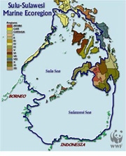
Map of the SSME created by WWF
| # | Documents | Filesize |
|---|---|---|
| 1 | 177,686 KB |
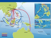
WWF Map on the Trade Routes of the Live Reef Fish Trade in the Coral Triangle Region
| # | Documents | Filesize |
|---|
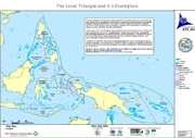
- Subject:
- Ecosystem-Based Management
- Type:
- Photos, Videos, and Maps
Map created through the Coral Triangle Atlas
| # | Documents | Filesize |
|---|
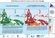
- Subject:
- Threatened Species
- Type:
- Photos, Videos, and Maps
Map created through the Coral Triangle Atlas
| # | Documents | Filesize |
|---|
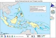
- Subject:
- Marine Protected Areas
- Type:
- Photos, Videos, and Maps
Map created through the Coral Triangle Atlas, December 2009
